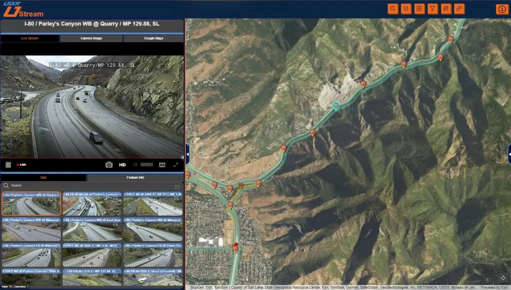
UDOT CCTV Streaming App
An internal ArcGIS application for live video from more than 2,000 UDOT cameras, built while the permanent viewing system was delayed.
Outcomes
- A feature layer stores locations, still-image URLs, and live-stream URLs for more than 2,000 cameras.
- Access uses existing ArcGIS Online accounts, single sign-on, group membership, and the organization's VPN.
- Maintenance crews open live roadway video from the map while the permanent system is delayed.
A video server was already ingesting and distributing cameras across the network. Staff still needed a practical way to find and open those streams. Winter was close, maintenance crews needed roadway video, and the permanent viewer was behind on schedule and cost.
An Experience Builder application uses a feature layer of camera locations, still-image URLs, and live-stream URLs. Staff find a camera on the map and open its video.
Sign-in uses existing ArcGIS Online accounts and single sign-on. Group membership controls who can open the application, and users reach the streams over the organization’s VPN.
It covered winter maintenance and other internal work with the video system and access controls already in place.